ArcGIS
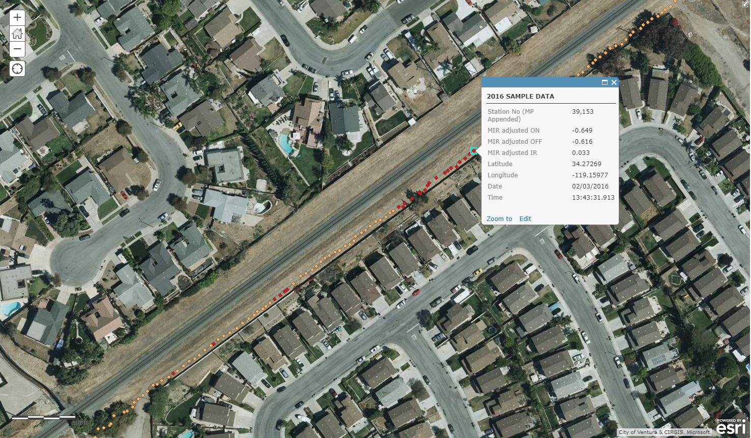
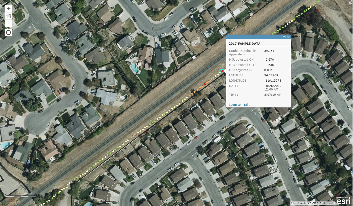
National Corrosion can provide graphical representations of data collected from CIS compatible with ArcGIS, Google Earth, and MS Excel.
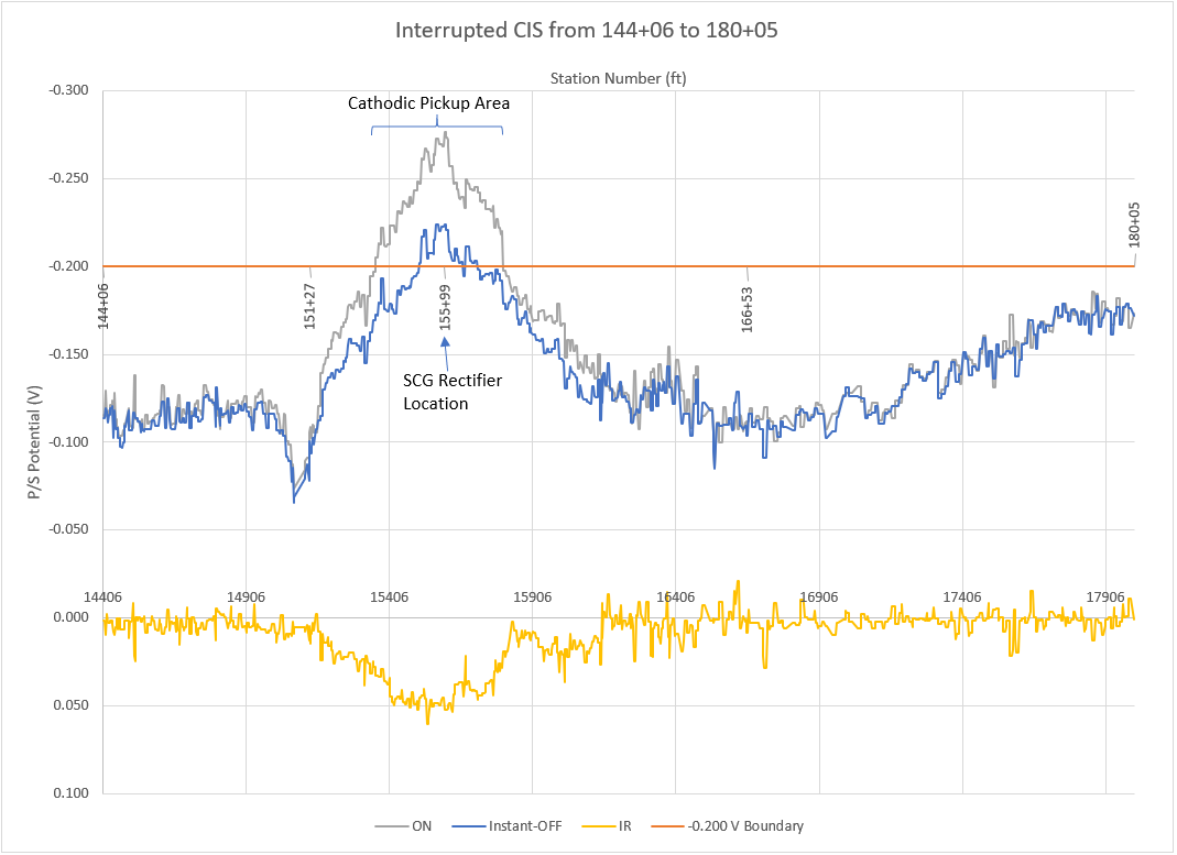
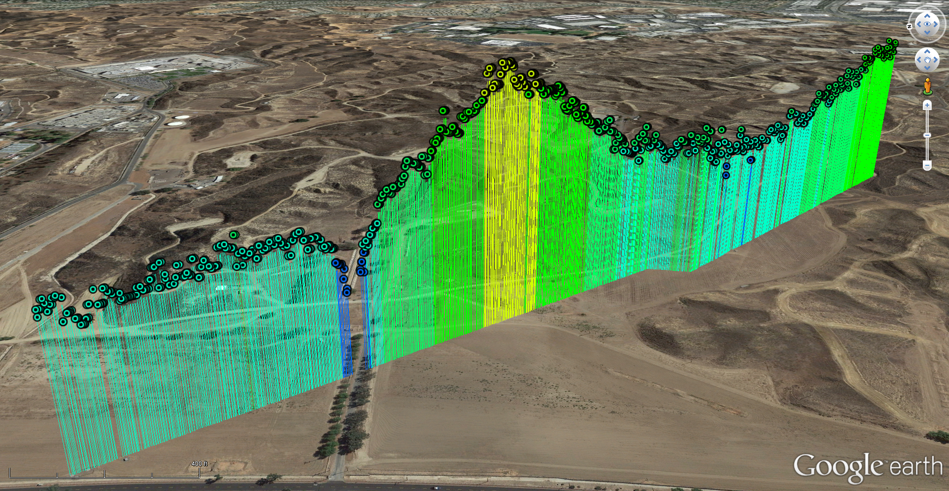

National Corrosion can provide graphical representations of data collected from CIS compatible with ArcGIS, Google Earth, and MS Excel.